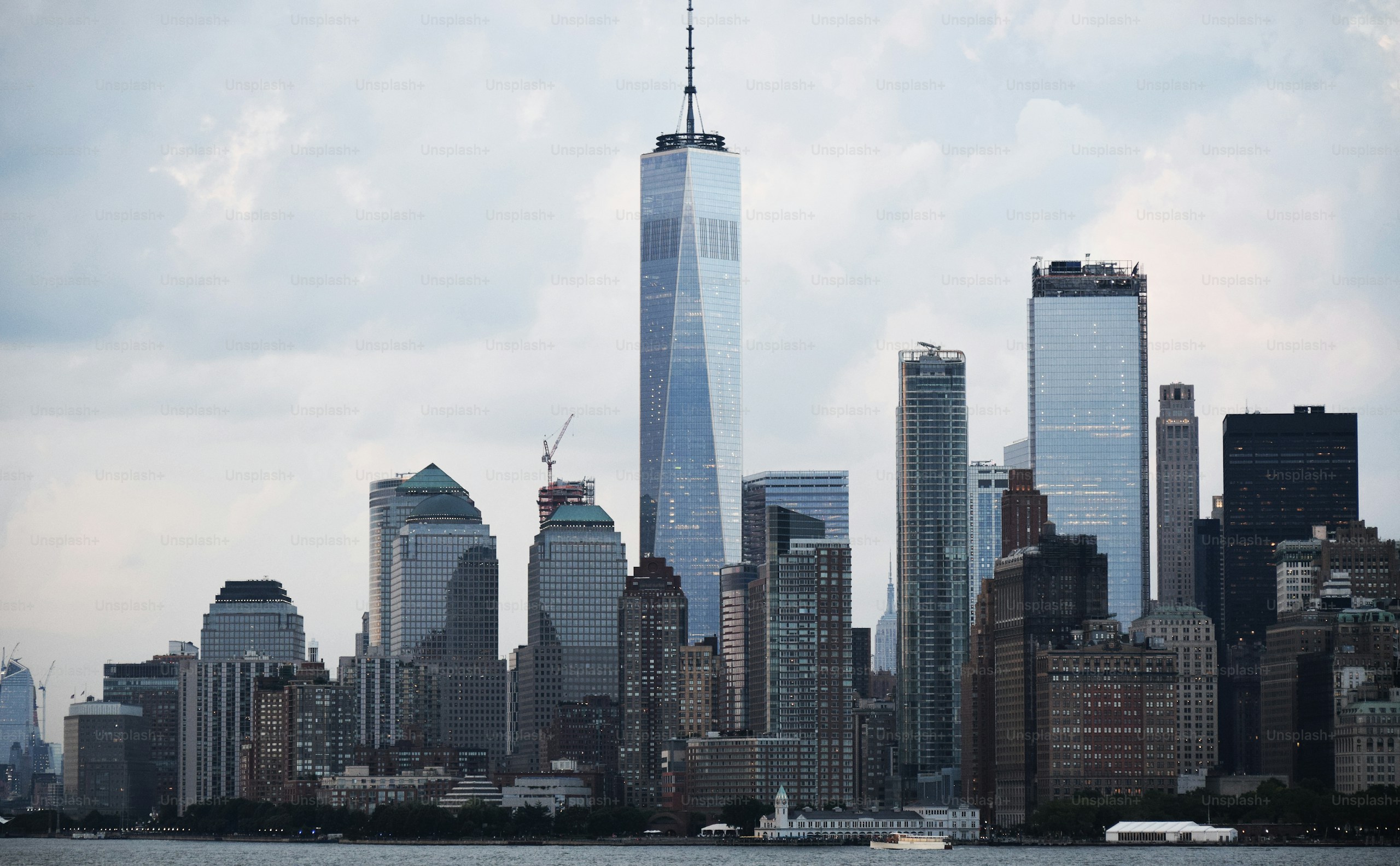
Facade Inspections
Can Drones Fully Replace Scaffolding and Gondolas? The Unfiltered Truth.
May 25, 2026
10 min read
I know the drone industry has a habit of overselling itself… and that leaves some room for skepticism. Understandably so, if you’re an inspector or building owner, you’d want to know exactly how far this technology can go before committing to it.
But here’s what no other drone company tells you: while drones genuinely provide superior documentation at a fraction of the cost, they’re not a silver bullet.
The good news is that this isn’t our first rodeo. After inspecting 20+ storey condominiums, shophouses, factories, and structures that don’t fit neatly into any category, we’ve tested the limits of this technology in-house.
In this article, we are going to cover where drones truly stand out, where they fall short, and how you can use the right balance of drone and human intervention to carry out a facade inspection in the fastest, most cost-efficient manner.
Where Drones Truly Stand Out
Reducing Your Dependence on Scaffolding

Scaffolding is often the biggest headache for building owners and contractors, and it’s easy to understand why. A single swing stage is usually the largest item on the bill and the most time-consuming one.
For example, a typical scaffolding setup for a 15-storey building costs between S$35,000 and S$60,000. When you include engineering labor and permits, the total often rises to between S$55,000 and S$95,000.
In comparison, a drone inspection of the same building costs S$900 to S$1,200 (with APS) and takes much less time to complete.
This results in a 60–80% cut in total inspection costs. Unlike scaffolding, which usually covers only 10-15% of a facade at a time, a drone can inspect 100% of all elevations in one go.
However, drones do not always fully replace swing stages. More on that later.
Imaging That Reduces Human Error

A gondola inspector sees what’s directly in front of them, limited by weather, fatigue, and specific light conditions. In contrast, a drone flies the same systematic pattern every single time, regardless of altitude or the complexity of the terrain.
AI-assisted defect detection adds another layer. Rather than one person reviewing thousands of images at the end of a long day, automated tools flag and classify anomalies like cracks, spalling, corrosion, and biological growth before the Competent Person even opens the report.
It doesn’t replace the Competent Person’s judgment. It just means they’re not starting from zero.
Thermal Imaging/Infrared Thermography

This is where things get truly interesting. Drone inspections start to seem less like a way to save money and more like a much better method for checking buildings.
Industry research suggests that up to one-third of the energy used by commercial buildings is lost through the building envelope, due to air leakage, thermal bridging, and inadequate insulation.
None of these issues can be seen with the naked eye. A tile may appear completely intact, while moisture has been quietly collecting behind it for months. This can slowly weaken the adhesive, soak the substrate, and work its way toward the structural layer. By the time the damage becomes visible, such as through a stain, a crack, or a tile that shifts underfoot, it’s often too late.
What began as a small entry point has turned into a costly repair project. Thermal imaging can detect the temperature differences caused by moisture and insulation failure before any surface signs appear.
This technology can mean the difference between a $500 sealant fix and a $150,000 reconstruction job.
In Singapore’s climate, where humidity is high and rainfall is heavy, buildings age faster than many owners realize.
This is not a theoretical concern.
It’s about when, not if.
Geolocation and 3D Modelling

Every image taken during a drone inspection is georeferenced. This means that defects are not only documented but also tagged with exact spatial coordinates, making them easier to find later.
When processed with photogrammetry software, the images can form a navigable, measurable 3D model of the building.
This model can be annotated, shared with your Competent Person, and referenced in future inspections.
For a building owner managing multiple properties or a facade inspector handling several projects at once, this represents a major improvement over a folder of unorganized photographs.
Where Human Intervention Is Still Required
Sounding and Tactile Testing
There’s a unique insight that only a human expert can gain from physically touching a surface—something that no photograph, no matter how high the resolution, can capture.
For instance, when you tap a hammer, the hollow sound it makes is one of the most dependable indicators of delamination lurking behind a tile. Right now, there’s simply no machine that can replicate that.
Physical Probing and Pull Tests
Taking core samples, conducting pull tests, and probing specific defect areas all necessitate a human being to physically access the facade. Unfortunately, there’s no alternative to this at the moment.
Professional Sign-Off
In Singapore’s PFI framework, a Competent Person is responsible for certifying the report. While drones provide them with more comprehensive and accurate data, they don’t take on the professional liability or replace the expert’s judgment.
Weather and Site Constraints
Professional-grade drones can handle winds of up to 25–30 mph, but for high-accuracy photogrammetry, flights are usually grounded when winds exceed 15–20 mph to avoid positional drift.
Singapore’s weather can change in a flash, and during monsoon season, it poses a real challenge. Additionally, sites located within 5km of Changi or Seletar Airport are required by law to have a tether system, which many drone operators in Singapore don’t have.
The Hybrid Workflow That Actually Works
Here’s how a BCA-compliant PFI operates when both methods are effectively combined:
Step 1 — Drone Screening First
The drone takes to the skies and scans 100% of the facade (both visual and thermal) in one go. Every defect is flagged, geotagged, and integrated into a 3D model of the building.
Step 2 — Data Review and Hotspot Identification
The Competent Person examines the drone’s findings and pinpoints the specific areas that need a closer look. Instead of deploying a swing stage across the entire building, they now have a targeted list of problem spots to investigate.
Step 3 — Targeted Swing Stage Deployment
Swing stages or rope access are only set up at the hotspots pinpointed by the Competent Person. Then, tactile checks, like hammer sounding, and the standard 10% close-range verification at the elevations are performed where they’re truly necessary.
Step 4 — Integrated Report
Once the drone data and hands-on findings are pulled together into a single TR-78 compliant report, it goes to the Competent Person for review and sign-off. That’s the workflow we follow at APS, and what gets submitted to BCA ends up being more comprehensive and harder to dispute than anything either method could put together in isolation.
The Practical Outcome
Rather than using swing stages to inspect an entire building, we fly a drone to pinpoint exactly where the issues lie, then deploy targeted, localized access only to those specific spots.
This approach leads to a faster, more focused, and cost-effective swing program.
In a world where machines are getting smarter, drone technology acts as a powerful supplement for facade inspections, not a replacement. Ultimately, the human at the end of the process is what makes all the difference.
Looking for expert drone pilots?
We've had conducted over 100+ inspections, have 7+ years of experience, and are BCA approved. Send a message to our team and get a professional answer!
Share: